Map View
The Map view shows the earth and the plane's position and path over it. It also allows you to create and fly to waypoints and scan patterns.
It can be displayed with the menu item View: Map.
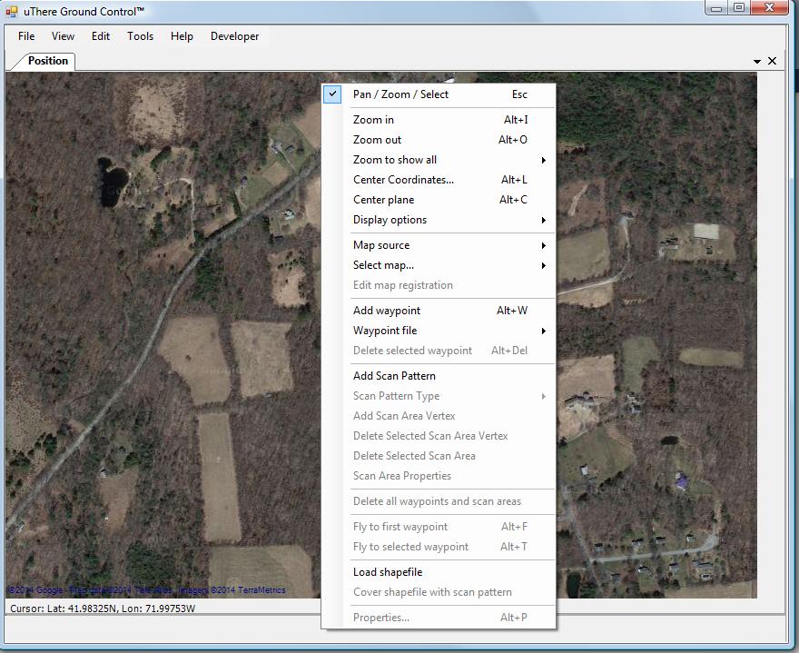
To access various functions, right click anywhere on the map display to show the menu.
To view a particular area
If you're at the field and GC is connected to a live plane, simply wait for the GPS to acquire a fix. Right-click on the Map window and select "Center Plane".
If you're preparing a mission to be loaded into Ruby at a later time:
Simply Zoom Out repeatedly until the world comes into view, and then pan and zoom in to the area of interest.
-or-
Right-click in the map area and select: Center Coordinates.... Enter the latitude and longitude somewhere near the area where you'd like to fly waypoints.
-or-
Use File: Open to open a flight data file from a past flight performed in the area in which you would like to fly waypoints.
Right-click and select "Zoom to show all: Path"
-or-
Use File: Waypoints: Open to load waypoints that you've previously created in the desired area.
Right-click and select "Zoom to show all: Waypoints"
Pan and zoom:
To pan, click and drag in the Map window.
To zoom in, double-click on the map -or- right-click and select "Zoom in" -or- press Alt + I.
To zoom out, hold down the shift key while double-clicking on the map -or- right-click and select "Zoom out" -or- press Alt + O.
Waypoints and Scan Areas
[more info]
|
|
|